Heart Trail Obergesteln - Geschinen


- 1:00 h
- 5.17 km
- 3 m
- 14 m
- 1,338 m
- 1,353 m
- Difficulty: easy
- Start: Obergesteln, station
- Destination: Geschinen, station
The Heart Trails of Switzerland were launched in winter 2015/2016 in collaboration with the Swiss Heart Foundation and Trails Switzerland, specially designed for heart patients. It is a short route without gradients. It offers beginners the opportunity to get to know the nature-connected winter sport and to keep fit. Heart patients should be motivated by the Heart Trails to stay physically active. The well-prepared trail runs picturesquely across the snowy plain between the mountain villages Obergesteln and Geschinen. The trail is part of the Sun Trail and can be easily combined.

Good to know
Best to visit
Directions
The Heart Trail starts at Obergesteln station and crosses the winter hiking trail at the village exit, where walkers can also be found. The route leads through the meadow, along the Tällibach stream to Flaxeie. Then it continues to Ulrichen, past a traditional farm. From there, the trail runs parallel to the hiking trail and crosses the Geschinerbach before finally ending at Geschinen station.
Tour information
Stop at an Inn
Equipment
We recommend:
- Good cross-country skiing equipment
- Weather-appropriate (water- and windproof) warm clothing and headwear
- Sunglasses
- Good sun protection, even in cloudy weather. UV rays at high altitudes can be particularly strong in winter.
Directions & Parking facilities
From Brig, follow Canton Road No. 19 (Furka Road) for 38.7 kilometers to Obergesteln.
Goms is also well connected from the Zurich / Lucerne region via Andermatt, Furka car shuttle.
The Alpine passes Furka, Grimsel and Nufenen are closed in winter. You can find the schedules for the Furka car shuttle at www.matterhorngotthardbahn.ch
Parking spaces near the station or in the village of Obergesteln are limited. Please follow the local parking guidance system.
Accessible by train and bus.
From Monthey, Martigny, Sion, Sierre and Visp: Get off in Brig. Then take the regional train (R43) of the Matterhorn Gotthard Railway. After 1 hour and 17 minutes, get off at Obergesteln.
Goms is also easily accessible from the Zurich / Lucerne region via Andermatt, Furka base tunnel.
You can find the train timetables at www.sbb.ch
Additional information
- Winter sports report at www.goms.ch/wintersportbericht
- Emergency number: 144
Timetable www.sbb.ch
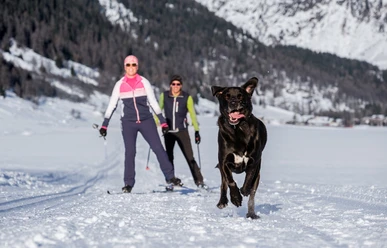
- Winter hikers, snowshoe walkers, and dog owners are not allowed to enter the cross-country ski trails.
Literature
At the tourist offices, at the sales points of the Goms trail, and in most hotels and restaurants in Obergoms you will find the following brochures:
- Winter map of Obergoms with trail plan
- Holiday guide
Author´s Tip / Recommendation of the author
With a valid Goms trail pass, you can travel free of charge with the Matterhorn Gotthard Railway between Oberwald and Fiesch – even without cross-country skiing equipment.
Safety guidelines
The Goms trail is open from 9:00 a.m. to 4:00 p.m. Use of the trails is at your own risk. Obergoms Tourism AG as well as the Goms trail disclaim any liability and accept no responsibility for the accuracy and completeness of the information on this website.
- Behave considerately towards other trail users. Every cross-country skier must adapt speed and behavior, especially on descents, to their ability and visibility. In classic tracks and on the piste for free technique, skiing is done on the right side with an appropriate safety distance to the skier ahead. Those who stop must step out of the trail.
- Through the winter sports report, you are always well informed about the current conditions (avalanche danger, trails, winter hiking paths, snowshoe trails, and road conditions).
- Only use marked trails and observe all signs and instructions – for your own safety, to protect grazing animals and without disturbing the peace of wildlife.
- Be considerate of the landscape. Take your rubbish and others' rubbish with you.
- Weather conditions in the mountains can change very quickly and without warning. Appropriate clothing is very important.
- Observe warning signals indicating dangers, especially avalanche danger.
- Providing assistance in case of accidents is a matter of course. To alert emergency services, dial 144.
Map
Nearby


")


