Via Sbrinz Obergesteln - Riale


- 7:00 h
- 19.16 km
- 1,186 m
- 823 m
- 1,350 m
- 2,492 m
- Difficulty: difficult
- Start: Obergesteln, train station
- Destination: Riale
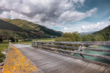
Our hike leads from Obergesteln to Riale (Kehrbäch) over the 2450 meter high Gries Pass. This hike is characterized by varied alpine landscapes and by the history of the emigrated Walser and their relationship with the old home in Goms.
If you want to walk the entire distance, you should allow around 7 hours of walking time. However, you can shorten the route by taking the post bus towards Nufenen and getting off at the Ladstafel stop. This saves walking time and ascent.
After the pass, you reach a "Mulattiera" into Valle Morasca and to the reservoir of the same name. Deep under the water surface lies the old Walser settlement Moraschg, which had to give way to modern times. Once in Riale, it is recommended to continue walking down the valley to the famous Tosa waterfalls.

Good to know
Pavements
Best to visit
Directions
Tour information
Cultural Interesting
Equipment
We recommend:
- Good footwear and hiking poles
- Sun and rain protection as well as warm clothing
- Detailed map or information material with good route preparation
- Provisions for your day in the open air
- First aid kit and mobile phone for emergencies
Directions & Parking facilities
From Brig, follow the cantonal road no. 19 (Furka road) for about 38 km to Obergesteln.
The Goms is also well connected from the Zurich / Lucerne region via Andermatt - Furka car shuttle www.matterhorngotthardbahn.ch.
With the regional trains of the Matterhorn Gotthard Railway, you can get from Brig to Obergesteln in 1 hour 17 minutes. The Goms is also easily accessible from the Zurich / Lucerne region via Andermatt - Furka Base Tunnel.
You can find the timetables of trains and buses at www.sbb.ch.
Additional information
- Summer report at www.goms.ch/sommersportbericht
- Timetable www.sbb.ch
- Emergency rescue telephone number: 144
Literature
At the tourist information offices as well as in most hotels and restaurants in Obergoms you will find the following brochures:
- Obergoms summer map with hiking, cycling and mountain biking routes
- Holiday guide
Author´s Tip / Recommendation of the author
Anyone who wants to admire a Maria on skis should make a detour to the chapel in Riale.
Safety guidelines
Use of the hiking trails is at your own risk. The Obergoms Tourism AG accepts no liability and assumes no responsibility for the accuracy and completeness of the information on this website. Carry a hiking map with you or download the complete description of the hiking trail with a large scale map. Use only marked trails and observe all markings and signs - for your own safety, for the protection of the landscape and in respect of wildlife. Behave considerately towards other trail users. Take your rubbish and that of others with you. Weather conditions in the mountains can change very quickly and without warning. Appropriate clothing and sufficient provisions (food and drink) are very important. In bad weather, it is better to turn back early. Bring additional sun protection. UV rays at high altitudes can be very strong, even in cloudy weather. Plan your route carefully and thoroughly. Inform yourself in advance about the current conditions and weather. The summer report provides valuable information from the region in this regard.
Map
Hiking map Goms, Rotten Verlag, 1:25'000
Topographic maps 1:25'000 Swisstopo: 1250 Ulrichen / 33 Basodino
Nearby


")


