Obergoms training trail


- 1:20 h
- 5.87 km
- 50 m
- 71 m
- 1,348 m
- 1,409 m
- Difficulty: difficult
- Start: Oberwald, station
- Destination: Obergesteln, Zwinge
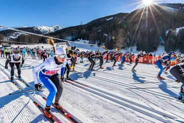
Between Oberwald and Ulrichen stretches a band over five kilometers long through the snow-covered mountain landscape. An ideal cross-country route to get in shape. Alongside the Obergoms training trail, the Grafschaft and Rhone Source training trails also belong to the Goms trail network.
Riding the training trails requires utmost concentration. The tough ascents of the black slopes really get the heart rate up and the descents are not meant for resting. On the Obergoms training trail, the highest and lowest points are only a few hundred meters apart. A fast finish is therefore guaranteed.
As challenging sections of the Goms trail, the training trails can be ideally combined with other trails. Linked together, they naturally create an interval training for perfect fitness.
With the Goms trail pass, you ride free of charge on the regional train Matterhorn Gotthard Bahn on the Oberwald-Fiesch route during the validity period.

Good to know
Best to visit
Directions
Oberwald, station - Lusse - Löüwene - Gsteini - Cheerbach - Bleetzene - (above) Restaurant Source du Rhône - Obergesteln - Obergesteln, Zwinge
Equipment
We recommend:
- Good cross-country skiing equipment
- Weather-appropriate (water- and windproof) warm clothing and headgear
- Sunglasses
- Good sun protection, even in overcast weather. UV rays at high altitudes can be especially strong in winter.
Directions & Parking facilities
From Brig, follow the cantonal road no. 19 (Furkastraße) for 40 km to Oberwald. Goms is also well connected from the Zurich / Lucerne region via Andermatt - Furka car shuttle train.
The Alpine passes Furka, Grimsel, and Nufenen are closed in winter. Timetables for the Furka car shuttle can be found at www.matterhorngotthardbahn.ch
With regional trains of the Matterhorn Gotthard Bahn you reach Oberwald from Brig in 1h 23 min. Goms is also easily accessible from the Zurich / Lucerne region via Andermatt - Furka Base Tunnel. Train timetables can be found at www.sbb.ch
.
Additional information
- Winter sports report at www.goms.ch/wintersportbericht
- Timetable www.sbb.ch
- Emergency services phone number: 144
- Winter hikers, snowshoers, and dog owners are not allowed to enter the cross-country trails.
Literature
At the tourist information offices, at sales points for the Goms trail, and in most hotels and restaurants in Obergoms you will find the following brochures:
- Obergoms winter map with trail plan
- Holiday guide
Author´s Tip / Recommendation of the author
Fancy a refreshing shower after training near the tracks? Facilities are available at the Nordic Center Ulrichen and at the trail control point Oberwald. From winter 2019/20, the new visitor center in Niederwald will also be available with changing rooms, lockers, and showers for athletes as well as a bistro for refreshments.
Safety guidelines
The Goms trail is open from 09:00 to 16:00. Use of the trails is at your own risk. The Obergoms Tourism AG and the Goms trail disclaim all liability and do not assume responsibility for the accuracy and completeness of the information on this website.
Use only marked trails and observe all markings and signs — for your own safety, to protect the landscape, and out of respect for wildlife.
Be considerate towards other trail users. Every cross-country skier must, especially on descents, adjust speed and behavior to their ability and visibility. In classic tracks and on the freestyle piste, keep a safe distance and ski on the right side behind the skier ahead. Those who stop should step out of the trail. Providing assistance in accidents is a matter of course. To alert emergency services, dial 144.
Weather conditions in the mountains can change very quickly and without warning. Appropriate clothing is very important.
Via the winter sports report you are always well informed about current conditions (avalanche danger, trails, winter hiking paths, snowshoe trails, and road conditions).
Map
Nearby
.jpg")


