Oberfäld Trail
")


- 1:30 h
- 3.80 km
- 199 m
- 199 m
- 1,359 m
- 1,551 m
- Difficulty: easy
- Start: Geschinen, valley station ski lift
- Destination: Geschinen, valley station ski lift
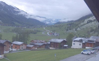
The Oberfäld Trail is a pleasant snowshoe path. Starting from Geschinen, the circular route leads through the protective mountain forest to Münster. Leaving behind the sun-tanned Valais houses and farm buildings of the main Goms village, you finally reach the starting point again via the snowy fields and meadows of Oberfäld.

Good to know
Pavements
Best to visit
Directions
Geschinen - Oberfäld - Münster - Lauinen - Chumme - Geschinen
Tour information
Loop Road
Equipment
We recommend:
- Good snowshoes
- Waterproof footwear and hiking poles
- Headwear as well as warm and protective outdoor clothing
- Sunscreen
- Detailed map or information material with good route preparation
- Provisions for your day in the open nature
- First aid kit and mobile phone for emergencies
Directions & Parking facilities
From Brig, follow the cantonal road No. 19 (Furka road) for 33 km to Geschinen. The Goms region is also well connected from the Zurich / Lucerne area via Andermatt - Furka car shuttle.
The Alpine passes Furka, Grimsel, and Nufenen are closed in winter. You can find the car shuttle schedules for Furka at https://www.matterhorngotthardbahn.ch/de/winter/anreise/autoverlad/furka/
With the regional trains of the Matterhorn Gotthard Bahn, you can reach Geschinen from Brig in 1 hour 11 minutes. The Goms region is also easily accessible from the Zurich / Lucerne area via Andermatt - Furka Base Tunnel. You can find the train schedules at www.sbb.ch
Additional information
Winter sports report at www.goms.ch/wintersportbericht
Timetable www.sbb.ch
Emergency rescue phone number: 144
Avalanche bulletin and snow conditions at www.slf.ch
Literature
Literature
In the tourist information centers, at the sales points of the Goms cross-country ski trail, as well as in most hotels and restaurants in Obergoms, you will find the following brochures:
- Winter map Obergoms with cross-country ski trail plan
- Holiday guide
Author´s Tip / Recommendation of the author
The Gommer Pass of the Matterhorn Gotthard Bahn entitles the holder to free travel on the Oberwald - Fiesch Feriendorf route in 2nd class.
Safety guidelines
Use of the snowshoe trails is at your own risk. Obergoms Tourismus AG disclaims all liability and assumes no responsibility for the accuracy and completeness of the information on this website.
Conditions on site may cause changes to the route. Carry a map with you or download the complete description of the hiking trail with a large-scale map. Use only marked trails and observe all markings and signs – for your own safety, to protect the landscape, and out of respect for wildlife. Behave considerately towards other trail users. Take your waste and others' waste with you.
Weather conditions in the mountains can change very quickly and without warning. Appropriate clothing and sufficient provisions (food and drink) are very important. In unstable weather, it is better to turn back early.
Carry additional sun protection. UV rays at high altitudes can be very strong, especially in winter, even under cloudy skies.
Plan your route carefully and thoroughly. Inform yourself in advance about current conditions (avalanche danger, cross-country ski trails, winter hiking trails, snowshoe trails, and road conditions) and weather conditions. The winter sports report provides valuable information from the region.
Map
Map/Maps
- Hiking map Goms, Rotten Verlag, 1:25,000
- Topographic maps 1:25,000 Swisstopo: 1250 Ulrichen
Nearby


Download GPX file