Furka Pass – Rhone Glacier


- 2:10 h
- 3.64 km
- 90 m
- 330 m
- 2,235 m
- 2,476 m
- Difficulty: easy
- Start: Furka Pass, pass height
- Destination: Furka Pass, pass height
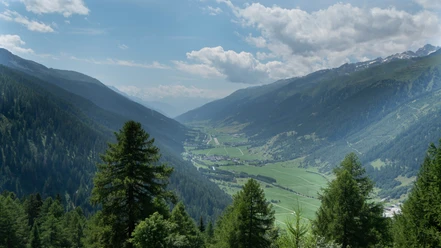
The path takes us comfortably from the Furka Pass to a unique viewpoint above the Rhone Glacier. This location is also attributed as the source of the Rhone.

Good to know
Pavements
Best to visit
Directions
From the Furka Pass, we follow the marked hiking trail up to the Rhone Glacier; the return is the same way.
Equipment
We recommend:
- Good footwear and hiking poles
- Sun and rain protection as well as warm clothing
- Detailed map or information material with good route preparation
- Provisions for your day in the great outdoors
- First aid kit and mobile phone for emergencies
Directions & Parking facilities
From Brig, follow the cantonal road no. 19 (Furka road) for about 40 km to Oberwald. From here follow route no. 6 to the Furka Passhöhe.
Goms is also well connected from the Zurich / Lucerne region via Andermatt - Furka car shuttle www.matterhorngotthardbahn.ch.
With the regional trains of the Matterhorn Gotthard Bahn, you reach Oberwald from Brig in 1 hour 23 minutes. Goms is also easily accessible from the Zurich / Lucerne region via Andermatt - Furka Base Tunnel.
Timetables for trains and buses can be found at www.sbb.ch.
Change in Oberwald to the PostAuto Furka Pass line to the Furka Passhöhe stop.
Additional information
Summer report at www.goms.ch/sommersportbericht
Timetable www.sbb.ch
Emergency service phone number: 144
Literature
In the tourist information offices and in most hotels and restaurants in Obergoms, you will find the following brochures:
- Obergoms summer map with hiking, cycling and biking trails
- Holiday guide
Author´s Tip / Recommendation of the author
This hike is a section of the Four Sources Route. We recommend spending more time in Obergoms and hiking the Four Sources Route independently.
Safety guidelines
IMPORTANT NOTICE!
The recent heatwave has also left its marks on the Rott Glacier. There is significant melting of the glacier (partly with ice breaks). Due to this, the already existing lake is growing larger.
- Due to the glacier retreat, rockfalls may occur in the area of the 'freeing slopes' at the access points to the glacier, the grotto, or the surroundings.
- Staying on the glacier tongue as well as in the area of the lake is also risky.
- The municipality of Obergoms therefore asks all persons present in the area of the Rott Glacier to be aware of this danger and act accordingly (self-responsibility). (July 2022 / municipality of Obergoms)
Use of the hiking trails is at your own risk. Obergoms Tourism AG assumes no liability and takes no responsibility for the accuracy and completeness of the information on this website.
Carry a hiking map with you or download the complete description of the hiking trail with a large scale map. Use only marked trails and observe all signs and notices – for your own safety, to protect the landscape, and out of respect for wildlife. Act considerately towards other trail users. Take your waste and others' waste with you.
Weather conditions in the mountains can change very quickly and without warning. Appropriate clothing and sufficient provisions (food and drink) are very important. In unsettled weather, it is better to turn back early.
Carry additional sun protection. UV rays at high altitude can be very strong, even when the sky is overcast.
Plan your route carefully and thoroughly. Inform yourself in advance about the current conditions and weather situation. The summer report provides valuable information from the region.
Map
Hiking map Goms, Rotten Verlag, 1:25'000
Topographic maps 1:25'000 Swisstopo: 133 Urseren
Nearby


