- 0:55 h
- 3.09 km
- 129 m
- 76 m
- 1,305 m
- 1,387 m
- Difficulty: easy
- Start: Selkingen, Selkingerstrasse
- Destination: Ritzingen, Field Chapel
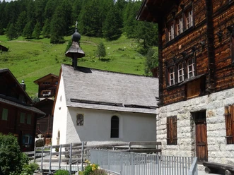
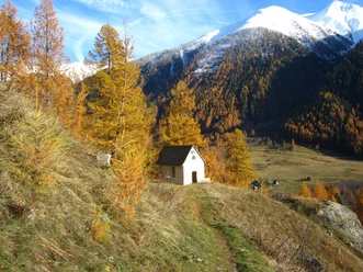
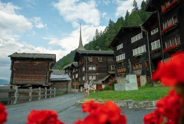
The Culture Path Grafschaft aims to bring locals and guests closer to their homeland or holiday destination in an inviting way. The path leads from Selkingen first through the lanes to Biel and finally to Ritzingen. The end point of the self-guided route lies "in the heart of the world," as the location of the Ritzingen Field Chapel is lovingly called in popular speech.
The free brochure for the Culture Path contains explanations about the villages and their utility and sacred buildings but also addresses topics such as population and customs. It also includes a list of further literature for those who wish to immerse themselves more deeply into the culture and history of the Upper Goms. The small book is available at the tourist information centers in Reckingen, Münster, and Oberwald.

Pavements
- Unknown (61%)Street (2%)Asphalt (30%)Path (7%)
Best to visit
- suitableDepends on weather
Directions
- Starting point Selkingen, Selkingerstrasse - SELKINGEN - Prefäktehüs (1) - Vorschutz House (2) - House with Saint Andrew's cross (3) - Original Heath house (4) - High Baroque house (5) - Renaissance house (6) - Fenner house (7) - Pfister house (8) - Stock mill (9) - Markus Chapel (11) - Ritz house (12) - Antonius Chapel (13) - BIEL - Barn group (19) - Heath house (20) - Hay barn group (18) - Vorschutz house (23) - Post house (23) - Grafe house (21) - Parsonage (16) - Schlosshubel (17) - Parish church (14) - Cemetery Chapel (15) - Avalanche Memorial (24) - RITZINGEN - Emergency Helper Chapel (25) - Anna Chapel (26) - Round arch gate (27) - Semi-detached house (28) - Barn (29.1) - Storehouse (29.2) - Stable barn (29.3) - Field Chapel (30)
Tour information
Culturally interesting
Refreshment stop
Suitable for prams/strollers
Equipment
We recommend:
- Waterproof footwear and hiking poles
- Headgear as well as warm and protective outdoor clothing
- Sun protection
- Detailed maps or informational material
Directions & Parking facilities
- Getting there
From Brig, follow the cantonal road No. 19 (Furka road) for about 26 km to Biel (VS). The Goms is also well connected from the Zürich / Lucerne region via Andermatt - Furka car shuttle.
The Alpine passes Furka, Grimsel, and Nufenen are closed in winter.
ParkingPublic parking is available in the villages of Selkingen, Biel (VS), and Ritzingen or at Biel (VS) train station. Please follow the local parking guidance system.Public transportationWith the regional trains of the Matterhorn Gotthard Bahn, you can reach Biel (VS) from Brig in 58 minutes. The Goms is also easily accessible from the Zürich / Lucerne region via Andermatt - Furka Base Tunnel.
Train and bus schedules can be found at www.sbb.ch.
Suitability
Families
Additional information
- Summer report at www.obergoms.ch/sommerbericht
- Timetable www.sbb.ch
- Emergency number: 144
Literature
At the tourist information centers, at the sales points of the Goms cross-country ski trail, and in most hotels and restaurants in Upper Goms, you will find the following brochures:
- Summer map and winter map Upper Goms
- Holiday guide (summer and winter)
- Culture Path Grafschaft brochure (D/F)
Author´s Tip / Recommendation of the author
- The churches and chapels of the Upper Goms invite you to pause, gather strength, say a prayer, or simply enjoy their beauty. Please come in!
Safety guidelines
Use of the theme trails is at your own risk. Obergoms Tourismus AG accepts no liability and assumes no responsibility for the accuracy and completeness of the information on this website.
Local conditions may cause changes to the route. Carry a map with you or download the complete description of the theme trail with a large-scale map.
Carry additional sun protection. UV radiation at high altitudes can be very strong, especially in winter, even with overcast skies.
Map
- Hiking map Goms, Rotten Verlag, 1:25'000
- Topographic maps 1:25'000 Swisstopo: 1250 Ulrichen / 1270 Binntal