Circular route Löwwigadmen (Reckingen)


- 0:30 h
- 1.85 km
- 80 m
- 43 m
- 1,327 m
- 1,407 m
- Difficulty: medium
- Start: Reckingen, junction station
- Destination: Reckingen, junction station
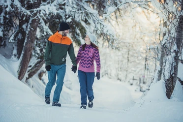
The small compact residential settlement Löwwigadmen lies just under 100 meters above the mountain village of Reckingen. The circular route is suitable for a short rejuvenating walk in the Goms winter landscape.
Behind the hamlet, an earth embankment was built after the avalanche winter of 1970 to protect against avalanches. A monument on the village square, opposite the start of this route, still commemorates the devastating natural disaster of the Bächital avalanche.
The prepared snow path can be combined as desired with other winter hiking trails of the extensive winter hiking trail network of Goms.

Good to know
Pavements
Best to visit
Directions
Tour information
Cultural Interesting
Stop at an Inn
Equipment
We recommend:
- Good footwear and hiking poles
- Sun and rain protection as well as warm clothing
- Detailed map or information material with good route preparation
- Provisions for your day in the open air
- First aid kit and mobile phone for emergencies
Directions & Parking facilities
From Brig, follow the cantonal road No. 19 (Furkastraße) for about 30 km to Reckingen.
Goms is also well connected from the Zürich/Lucerne region via Andermatt - Furka car shuttle.
The Alpine passes Furka, Grimsel, and Nufenen are closed in winter.
With the regional trains of the Matterhorn Gotthard Bahn you can reach Reckingen from Brig in 1h 03 min. Goms is also easily accessible from the Zürich/Lucerne region via Andermatt - Furka Base Tunnel.
Train and bus timetables can be found at www.sbb.ch.
Additional information
- Winter sports report at www.obergoms.ch/wintersportbericht
- Timetable www.sbb.ch
- Emergency service phone number: 144
- Avalanche bulletin and snow situation at www.slf.ch
Literature
At the tourist information offices, at the sales points of the Goms cross-country ski trail, and in most hotels and restaurants in Obergoms, you will find the following brochures:
- Winter map Obergoms with cross-country ski trail plan
- Holiday guide
Author´s Tip / Recommendation of the author
The Gommer Pass of the Matterhorn Gotthard Bahn entitles the holder to free travel on the Oberwald - Fiesch Feriendorf route in 2nd class
Safety guidelines
Using the winter hiking trails is at your own risk. Obergoms Tourismus AG accepts no liability and assumes no responsibility for the accuracy and completeness of the information on this website.
Carry a hiking map with you or download the complete description of the trail with a large-scale map. Use only marked trails and observe all signs and notices - for your safety, to protect the landscape, and out of respect for wildlife. Behave considerately towards other trail users. Take your waste and other people's waste with you.
Weather conditions in the mountains can change very quickly and without warning. Appropriate clothing and sufficient provisions (food and drink) are very important. In bad weather, it is better to turn back early.
Carry additional sun protection. UV rays at high altitudes can be very strong in winter, even under cloudy skies.
Plan your trip carefully and thoroughly. Inform yourself in advance about current conditions (avalanche risk, cross-country ski trails, winter hiking trails, snowshoe trails, and road conditions) and weather conditions. The winter sports report provides valuable information on this from the region.
Map
- Hiking map Goms, Rotten Verlag, 1:25,000
- National maps 1:25,000 Swisstopo: 1250 Ulrichen / 1270 Binntal
Nearby


")


