- Photos & Map
How would you like to arrive?
- Description
- Good to know
- Nearby
Download GPX file
- 2:15 h
- 12.02 km
- 505 m
- 505 m
- 1,299 m
- 1,789 m
- 490 m
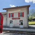
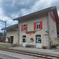
- Start: Reckingen train station
- Destination: Reckingen train station
Starting from Reckingen, the route follows a good road with a pleasant, steady incline up to point 1789. Here, the trail follows the Gommer Höhenweg. If you need a refreshment after the 550 meters of ascent, a detour to the charming Bergbistro Guferschmatte is recommended. Then it continues on flowing, varied hiking trails past the Glürigerstafel (1808) to the junction at point 1622 in Bawald. This is followed by a steep downhill on hiking paths through the village of Gluringen before crossing the main road and passing Gluringen train station to reach the other side of the Rotten river. The flat hiking and bike path along the Rotten leads back to Reckingen to the starting point of the route.
Good to know
Pavements
Best to visit
Directions
Reckingen train station - Fäld - Jungholzhalte - Wiler - point 1715 - point 1789 - mountain hut Guferschmatte - Scheeni Biele - Glürigerstafel - point 1779 - point 1622 - Oberfäldhalte - Gluringen - Gluringen train station - point 1300 - bridge over the Rotten - Riverside Camping - Reckingen train station
Tour information
Loop Road
Stop at an Inn
Equipment
We recommend:
- Trail running shoes with good grip
- Sun and rain protection as well as warm clothing
- Detailed map or information material with good route preparation
- Provisions for your day in the great outdoors
- First-aid kit and mobile phone for emergencies
Directions & Parking facilities
Take the Matterhorn Gotthard Bahn to Reckingen.
Additional information
Author´s Tip / Recommendation of the author
Wonderful route in autumn when the larches glow golden. A stop at the Bergbistro Guferschmatte is definitely worthwhile.
Safety guidelines
Using the hiking trails is at your own risk. Obergoms Tourismus AG disclaims all liability and assumes no responsibility for the accuracy and completeness of the information on this website.
Carry a hiking map with you or download the complete description of the route with a large-scale map. During your tour, it is advisable to use only marked paths and roads. Observe all signposts and instructions—for your own safety, to protect the landscape, and out of respect for wildlife. Behave considerately toward other trail users. Take your rubbish and that of others with you.
The weather conditions can change very quickly and without warning in the mountains. Appropriate clothing and sufficient provisions (food and drink) are very important. In unstable weather, it is better to turn back early.
Carry additional sun protection. UV rays at high altitudes can be very strong, even under cloudy skies.
Plan your tour carefully and thoroughly. Inform yourself beforehand about current conditions and weather. The summer report provides valuable information from the region.
Nearby


